Navigating the World Through Satellite Imagery Innovations
Navigating the World Through Satellite Imagery Innovations
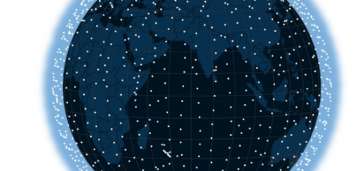
In the serene expanse above, satellites conduct a meticulous observation, not just for celestial exploration but for the detailed scrutiny of Earth’s surface, emphasizing the critical importance of satellite imagery for numerous spheres and industries. This endeavor reveals the intricate dynamics of climate change, biodiversity, and human influence on the terrestrial landscape.
Entire constellations of satellites serve as a conduit for a wealth of data, fostering innovation and collaboration while offering an unparalleled perspective on global developments. It pushes industry leaders to thoughtfully integrate this information, enhancing societal progress and sustainability. One case is the use of daily satellite imagery for agriculture, which has revolutionized the way farmers monitor and manage their crops. So, let’s see how modern satellite tech has made this possible.
Satellite Monitoring
Spatial imaging technology stands at the forefront of the space sector, employing sophisticated monitoring and visualization tools. These utilize optical sensors that replicate human vision, capturing imagery based on the reflection of solar light off surfaces, resulting in visuals that are both relatable and easy to grasp. However, this represents just a small fraction of what spatial imaging technology encompasses.
For example, thermal imaging through infrared (IR) technology provides an alternative lens, capturing the thermal signatures emitted by objects. This is particularly beneficial across various domains such as forest management, where it can pinpoint potential fire outbreaks by detecting unusually warm areas, or in agriculture, where it helps in identifying crops under stress before any visible signs of the problem appear.
Moreover, technologies like Synthetic Aperture Radar (SAR) expand the capabilities of spatial imaging by utilizing microwaves to penetrate atmospheric obstructions like clouds and darkness, ensuring continuous observation regardless of weather conditions or time of day. SAR is indispensable for maritime surveillance and for monitoring changes in arctic regions, which are often obscured by cloud cover or plunged into prolonged periods of darkness.
Each imaging method offers distinct benefits, tailored to meet the specific demands of a given task. While some techniques provide expansive views covering large territories, others specialize in the intricate examination of detailed features. Certain methods are adept at identifying specific substances or activities, whereas others provide a comprehensive snapshot of our planet. The expansion of imaging methodologies is unveiling an unparalleled level of detail and scope in our understanding of the Earth’s surface.
The Dawn of Daily Satellite Imagery
The era of uncertain satellite observations of specific terrestrial regions is a thing of the past. Now, an extensive network of Earth-observing satellites encircles our planet, providing daily, high-definition pictures of its every corner. This transformation is the result of significant strides in satellite engineering, the miniaturization of satellite components, and a surge in satellite deployments, ensuring a relentless and detailed surveillance of the terrestrial facade.
However, transforming satellite imagery into actionable intelligence involves an intricate process beyond merely collecting data. It necessitates a robust framework to handle the voluminous data extracted by satellites. The next step involves deciding the type of analysis required — be it spectral, temporal, or the application of advanced machine learning techniques. Following the extraction and analysis of this data, it is imperative to establish a user-friendly access point, enabling users to tap into these insights from their respective locations.
Satellite Data Transforming Industries
As we move from the realm of processing satellite imagery to its real-world applications, we see a transformative impact across various industries, showcasing the broad spectrum of possibilities unlocked by this advanced technology.
In agriculture, it enables precision farming, optimizing decisions on planting and harvesting, and aids in sustainable practices through soil monitoring and crop inspection, contributing to better yield forecasts and resilience against climate change.
The forestry sector benefits from satellite data through enhanced management of forest locations, detection of illegal logging, and monitoring of forest health and carbon stocks, which supports sustainable resource use and aids in fire prevention and post-disaster restoration.
In fisheries, satellite data assists in extreme weather preparedness, optimizing operations such as stocking and harvest timing, and in the sustainable management of aquaculture, including site optimization and monitoring of water quality. It also plays a crucial role in combating illegal fishing and in the mapping of marine-protected areas.
The insurance industry leverages satellite data for risk modeling, enhancing the assessment and approval of claims, and for a more accurate valuation of assets. This data helps in mapping risk-prone areas, leading to better-informed premium setting and faster response to disasters.
The mining and energy sectors benefit from the predictive insights satellite data provides on weather conditions, aiding in prospecting, exploration, and regulatory compliance. It ensures the monitoring of remote infrastructure and environmental impacts, minimizing damages from potential hazards like oil spills or chemical leaching.
Success Fueling Innovations
As satellite data continues to reshape industries from agriculture to mining, the focus naturally shifts to the innovations in satellite technology itself. These technological advancements are not just enhancing existing applications but are also paving the way for new possibilities across various sectors.
The miniaturization of satellite technology and more affordable launch costs have broadened access to space, enabling the creation of extensive satellite constellations. This shift has enhanced the detail and scope of satellite imagery, bringing about the possibility of daily updates. More so, it has opened a possibility for companies to launch their own satellites for specific purposes. Among them are small optical agri-focused satellites that can monitor up to one million square kilometers daily using 11 agri-related bands.
At the same time, enhanced optical sensors are now providing unprecedented, detailed views of Earth, achieving resolutions as fine as 0.3m². These advancements allow for a deeper understanding of both natural phenomena and human activities. Complementing optical sensors, hyperspectral sensors onboard satellites are capturing data at the molecular level, offering insights into soil composition, vegetation types, and water quality. Furthermore, synthetic aperture radar technology is breaking new ground by delivering high-resolution imagery even through obstacles like clouds and darkness, where traditional optical instruments falter.
The challenge lies in managing and interpreting the immense volumes of satellite data generated daily. Here, three pivotal technologies converge to streamline this process: cloud-based applications ensure efficient data storage and processing; machine learning automates the complex task of image analysis; and Edge AI enables satellites to process data in orbit, sending only the most critical information back to Earth, significantly speeding up the delivery of insights.
As we venture further into the age of satellite techinnovations, the horizon of possibilities continues to expand. The mentioned advancements not only deepen our understanding of our planet’s surface but also pave the way for innovative applications across diverse sectors.
Related Posts
- 5G Satellite Architecture | Transparent and Regenerative Payload
- 3GPP Frequency Bands for 5G Satellite Communication
- 3GPP 5G Advanced Features